In the dynamic field of urban planning and architecture, GISCARTA takes center stage as a powerful GIS platform designed to empower professionals with the tools they need to shape vibrant and sustainable urban environments. With our platform, urban planning becomes a collaborative journey driven by data insights and informed decision-making.
Urban Planning
URBAN PLANNING
Optimizing Urban Mobility and Accessibility
GISCARTA equips urban planners and architects with advanced routing capabilities, enabling them to identify optimal pathways for transportation and infrastructure development. Accessibility zones inform the strategic placement of key amenities and services, ensuring that urban spaces are accessible and well-connected for residents and businesses alike.


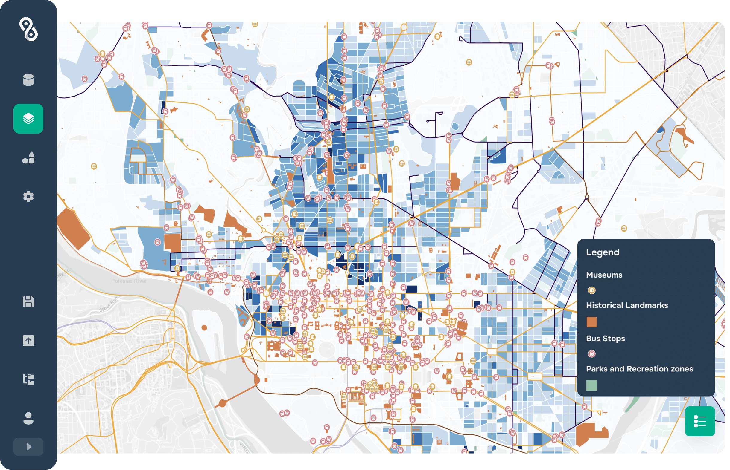
URBAN PLANNING
Unlocking Urban Potential with Data
In the realm of urban planning, information is power. Dive deep into property details, zoning regulations, and infrastructure specifics with a mere click. Whether you're scouting locations for a new park or strategizing public transport networks, GISCARTA puts comprehensive urban data right at your fingertips.

URBAN PLANNING
Compelling Visual Storytelling
When it's time to convey your urban vision, our platform delivers. Craft breathtaking thermal maps, intelligently label features, and achieve crystal-clear communication with clustering. Elevate your ability to illustrate ideas and captivate your audience, whether you're engaging with stakeholders or the broader public.

Other use cases
Make your own project
This website uses cookies to ensure you get the best experience
OK