
El transporte y la logística modernos se parecen cada vez menos a los esquemas clásicos de viaje de punto a punto. Hoy son sistemas complejos en los que se cruzan rutas, restricciones, demanda y condiciones reales del tráfico. Con el crecimiento del comercio electrónico, la urbanización y los volúmenes de transporte, gestionar estos flujos se vuelve cada vez más difícil.
En este entorno, los sistemas de información geográfica (SIG) se están convirtiendo en algo más que una herramienta de visualización; son la base para el análisis y la toma de decisiones. Nos permiten ver el transporte no como un conjunto de rutas, sino como un sistema espacial dinámico.
El transporte como una red espacial
La mayoría de los problemas de transporte se basan en una idea simple: todo sucede en el espacio. Las carreteras, los almacenes, las tiendas y los centros de transporte: todos son elementos de una sola red.
El SIG permite representar esta red como un grafo, donde:
las carreteras son enlaces
las intersecciones y los objetos son nodos
el tiempo o la distancia es el "peso" de cada segmento
Este modelo permite aplicar algoritmos de enrutamiento, análisis de accesibilidad y distribución de flujos. ¿Dónde se utiliza el SIG en el transporte?
Optimización de rutas
Una de las tareas más comunes es construir una ruta óptima. Esta puede ser la ruta más corta o una ruta que tenga en cuenta restricciones como la velocidad, el tipo de carretera o la congestión.
Empresas de reparto como Amazon utilizan algoritmos similares para minimizar los tiempos de entrega y reducir costos.
Análisis de accesibilidad
No siempre importa cuán lejos esté una instalación. Lo más importante es cuánto tiempo se tarda en llegar.
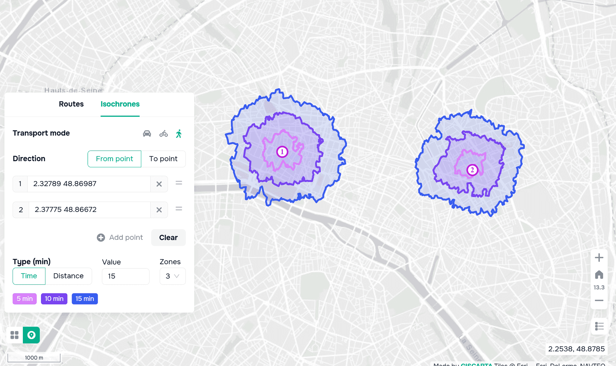
Aquí se utilizan las isocronas: zonas que muestran la accesibilidad de un punto en un tiempo determinado. Por ejemplo, se puede estimar qué áreas de la ciudad están a 15 minutos de un almacén o una tienda.
Estos enfoques se utilizan activamente en servicios como Uber para calcular los tiempos de recogida y distribuir la demanda.
Gestión del flujo de tráfico
El SIG ayuda a analizar el flujo de tráfico e identificar áreas problemáticas. En las ciudades, estos sistemas se utilizan para: optimizar los semáforos, reducir la congestión, analizar la congestión vial.
Esto permite no solo reaccionar ante los problemas, sino también preverlos con antelación.
Planificación de infraestructuras
El SIG también se utiliza en la etapa de planificación. El análisis espacial puede ayudar a determinar:
¿Cuál es el mejor lugar para ubicar un almacén?
¿Qué zonas carecen de suficiente infraestructura?
¿Cómo cambiará la accesibilidad después de la construcción de una carretera?
Estos desafíos son relevantes tanto para las empresas como para la planificación urbana.
¿Qué datos se utilizan?
Los datos son la base de cualquier análisis. Los proyectos de transporte suelen utilizar:
– OpenStreetMap: red vial
– Trazas GPS: rutas reales de tráfico
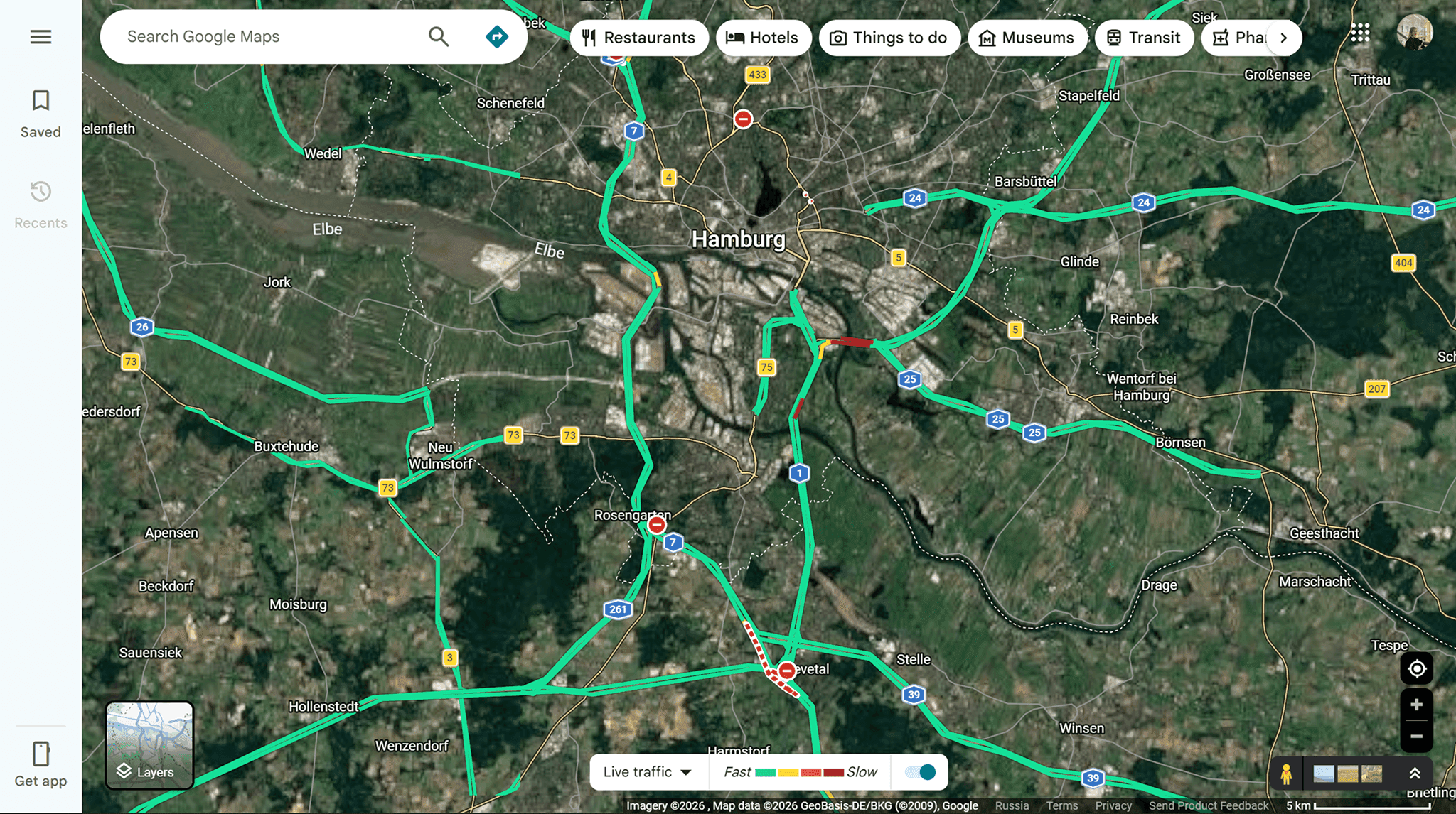
– Datos de tráfico (por ejemplo, Google Maps)
– Datos internos de la empresa (pedidos, almacenes, rutas)
Cuanto más precisos y actualizados sean los datos, más fiables serán los resultados.
Herramientas
Hoy en día hay disponibles una variedad de herramientas para trabajar con datos de transporte.
QGIS se utiliza a menudo para análisis en profundidad. Permite construir rutas, analizar redes y configurar escenarios complejos. Las soluciones más comunes son los complementos QNEAT3 y ORS Tools.
Si se necesita velocidad y simplicidad, las plataformas web como GISCARTA son más cómodas. Permiten:
construir rutas e isocronas
analizar la accesibilidad
visualizar datos rápidamente sin preparación
Obtenga más información sobre el widget de Analítica de Transporte en la documentación o en el blog.
Los servicios de enrutamiento como OpenRouteService y Mapbox, que pueden integrarse en aplicaciones, también se utilizan ampliamente.
Puede leer más sobre la construcción de isocronas en nuestro blog.
Limitaciones y matices
A pesar de sus capacidades, es importante considerar las limitaciones.
Los datos pueden ser:
incompletos
desactualizados
no reflejar las condiciones reales del tráfico
Además, un modelo siempre simplifica la realidad. Por lo tanto, los resultados del análisis requieren interpretación.
¿Hacia dónde se dirige la industria?
El desarrollo del SIG en el transporte avanza hacia sistemas más dinámicos.
Las áreas clave incluyen:
trabajar con datos en tiempo real
integración con IoT (sensores, transporte)
uso de IA para la previsión
creación de gemelos digitales de las ciudades
Estos sistemas permiten no solo analizar la situación actual, sino también modelar escenarios futuros.
Preguntas frecuentes
¿Cómo se utiliza el SIG en la logística?
El SIG ayuda a optimizar rutas, analizar zonas de entrega y reducir los costos de transporte mediante una planificación más eficiente.
¿Se pueden usar datos abiertos para el análisis del transporte?
Sí, fuentes como OpenStreetMap se utilizan ampliamente para el mapeo de rutas y el análisis de redes de transporte.
¿Cuándo es mejor usar SIG web en lugar de soluciones de escritorio?
Las plataformas web son adecuadas para análisis y visualización rápidos, mientras que el SIG de escritorio es mejor para cálculos complejos y escenarios personalizados.
Conclusiones clave
El SIG permite considerar el transporte y la logística como un sistema espacial unificado, donde las rutas, la accesibilidad y los tiempos desempeñan un papel clave.
Los datos de alta calidad y actualizados son esenciales para un análisis preciso del transporte y la logística.
Combinar el análisis espacial con restricciones del mundo real conduce a una toma de decisiones más eficiente en los sistemas de transporte.


