Build Interactive Maps &
Build Interactive Maps &
Build Interactive Maps &
Build Interactive Maps &
Build Interactive Maps & Dashboars
in Minutes
Dashboards in Minutes
Dashboards in Minutes
Dashboards in Minutes
Dashboards in Minutes

Everything you need to work with geodata
Everything you need to work with geodata
Everything you need to work with geodata
Everything you need to work with geodata
Import data in various formats and enrich it with AI
Import data in various formats and enrich it with AI
Import data in various formats and enrich it with AI
Import data in various formats and enrich it with AI
All the formats you use: CSV, GeoJSON, SHP, TIF, XLSX, GeoPackage, KML, GPX, and ArcGIS JSON. Use Geodata AI to extract data from OSM and Overture.

Draw insights from your data with 40+ analytical tools
Dashboards for clear visual reporting, storybook to create interactive map narratives, elevation profiles to explore terrain and many more —all in one intuitive platform

Draw insights from your data with 40+ analytical tools
Draw insights from your data with 40+ analytical tools
Draw insights from your data with 40+ analytical tools
Draw insights from your data with 40+ analytical tools
Dashboards for clear visual reporting, storybook to create interactive map narratives, elevation profiles to explore terrain and many more —all in one intuitive platform
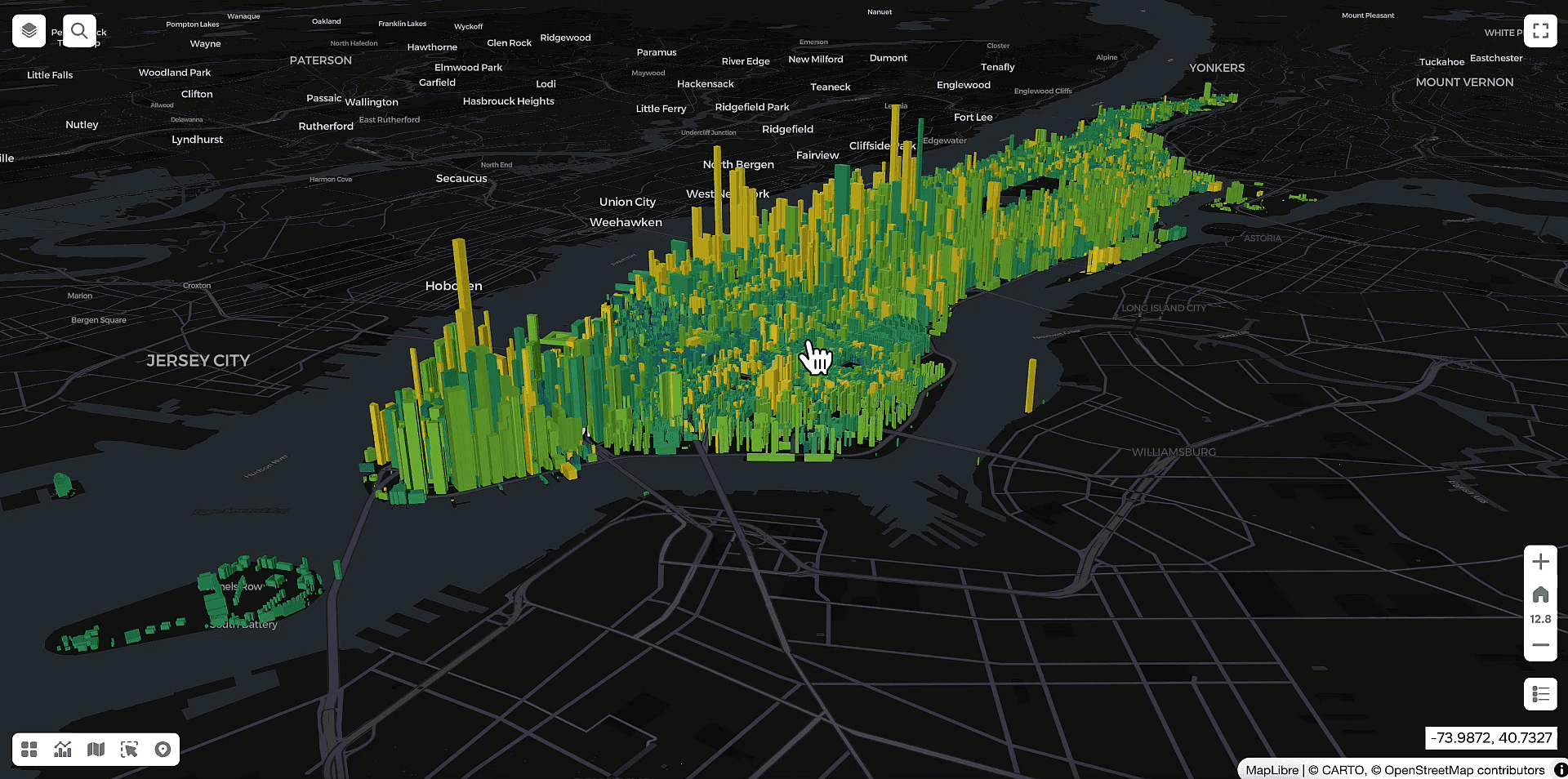
Create stunning visualisations to tell your story
Create stunning visualisations to tell your story
Create stunning visualisations to tell your story
Create stunning visualisations to tell your story
3D views and dynamic heatmaps to reveal patterns, interactive choropleth maps, and smart clustering to highlight key trends—all designed for clear, actionable visual storytelling.

Engage clients and partners by sharing your maps
Share your project publicly with a single link, or keep it private using password protection for secure access. Easily embed your maps directly into any website or print them for reports and presentations.

Engage clients and partners by sharing your maps
Engage clients and partners by sharing your maps
Engage clients and partners by sharing your maps
Engage clients and partners by sharing your maps
Share your project publicly with a single link, or keep it private using password protection for secure access. Easily embed your maps directly into any website or print them for reports and presentations.
Explore how our GIS platform can help you solve your tasks
Maps are essential tools for professionals across various industries, from urban planning to mining and forestry


If you want your own GIS platform on-premise without license payments, GISCARTA is your choice
Unlimited number
of users and projectsInstallation on your servers
Role-based access model
Customized features
Unlimited number
of users and projectsInstallation on your servers
Role-based access model
Customized features
Unlimited number
of users and projectsInstallation on your servers
Role-based access model
Customized features
Frequently Asked Questions
What can the GISCARTA platform be used for?
Can the GISCARTA platform be used for free?
What do I need to register on the GISCARTA platform?
Who can use the GISCARTA platform?
How can I create a project?
What data can be added to the map?
Can I upload my own data to the map?
How do I publish a web map?
How can I see what the published web map will look like?
Is it possible to add data from ArcGIS or GeoServer to the map?
Can I set a password for my published web map?
How is GISCARTA different from Google maps?
Can I install GISCARTA locally on an internal server?

Start making your map for free
Start making your map for free
Start making your map for free
Start making your map for free
SUPPORT
© 2026 GISCARTA
SUPPORT
© 2026 GISCARTA
SUPPORT
© 2026 GISCARTA