Configure basic map settings here.
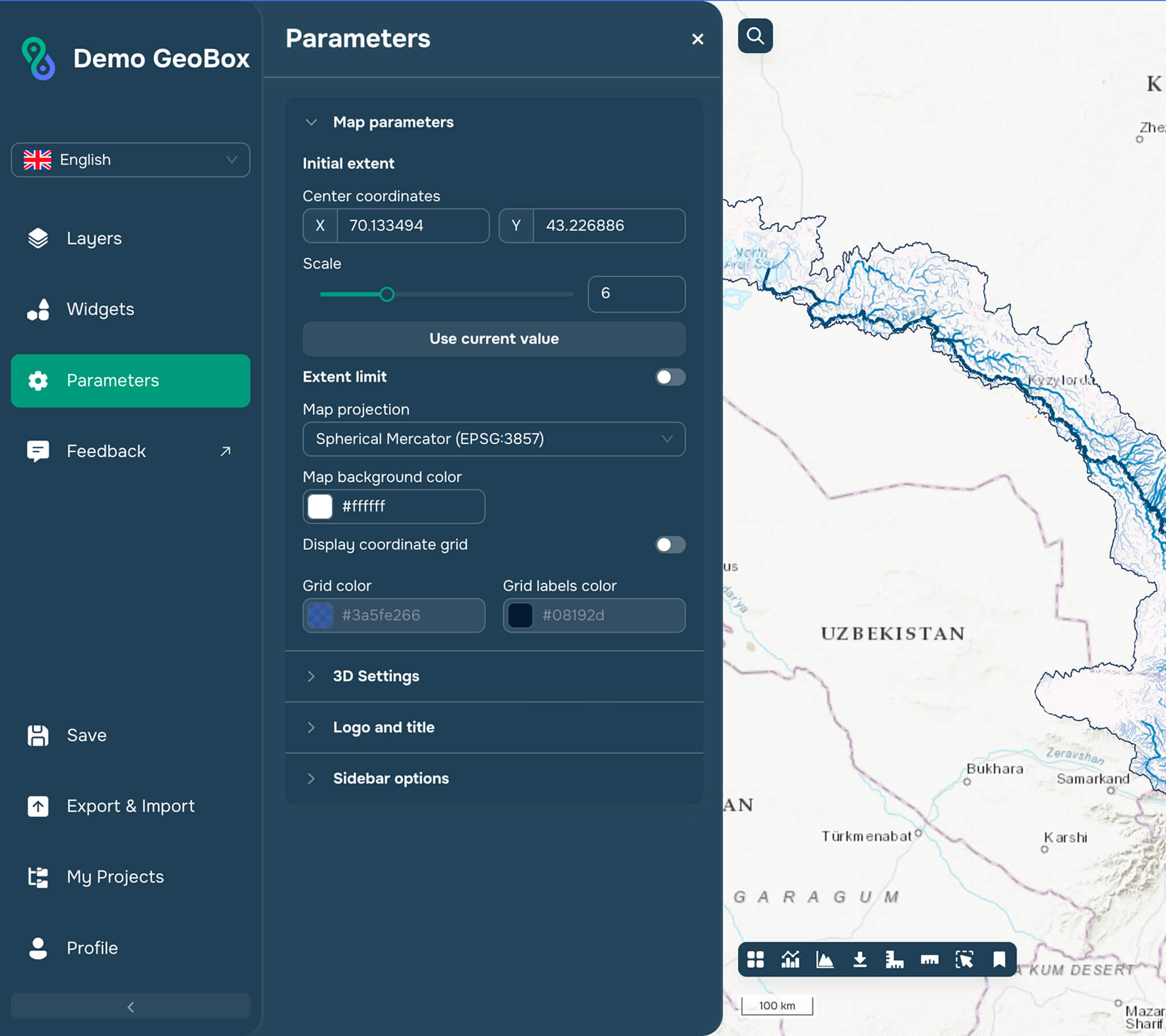
Map settings
This is where you can configure the map’s initial extent, i.e. what part of the earth’s surface you see when you open the application and at what scale. You can extent limit (zoom in and zoom out).
There are two ways to do so:
Manually enter the center coordinates and map scale
Save the current map position by clicking "Use current value." The parameters will be filled in automatically.
You can also limit the extent of the created map so that end users cannot view the map outside the boundaries you set.
You can select the projection you need from the drop-down list:
Mercator projection
North Pole projection
South Pole projection
You can also choose the background color of the map by selecting it in the corresponding window.
3D Settings
Here you can enable or disable terrain display for the 3D map view mode.
Logo and title
Here you can change the map design by specifying the name and description. The map logo is added by URL address.
Side bar options
Here you can specify whether to expand or hide the sidebar when opening the application.