In this section, you can:
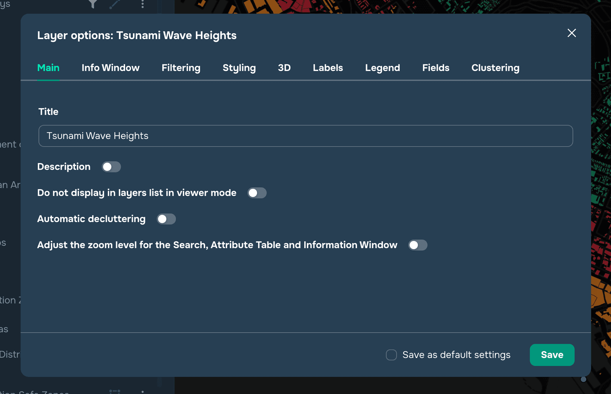
Rename the data layer by typing its name in the corresponding field
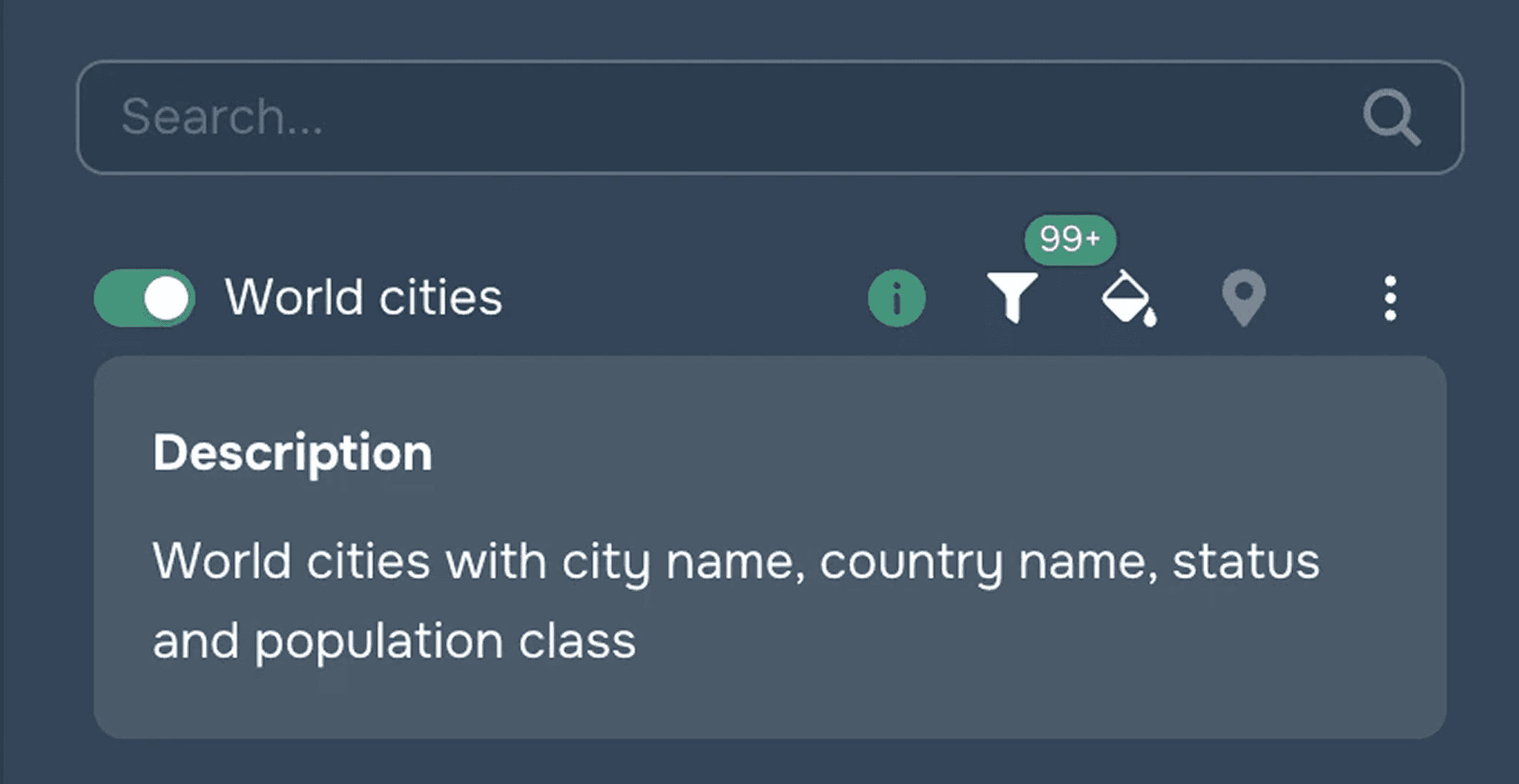
Add a description of the layer, which will be available for viewing by the external user (see Figure 2)
Use the slider to adjust its transparency (when the Layer transparency widget is enabled)
Customize the visibility of the layer at different zoom levels (if the Layer Visibility widget is enabled)
For polygon and point layers, configure object generalization. For points, this means whether all objects will be shown at once or whether automatic generalization will be enabled depending on the map's zoom level. For polygons, this means automatic conversion from polygons to points at certain zoom levels.
Customize the display of the layer in the layer list for the end user (used for service layers)
Adjust the zoom level to get closer to the object using search tools, attribute tables, and info windows