
When we open a map, the first thing we see is its foundation—the background layer. Roads, cities, labels, and terrain provide context that helps us understand where events are taking place and how objects are connected. Basemaps fulfill this function.
Even the most accurate analysis can be poorly understood if it's overlaid on an inappropriate base. Therefore, choosing a basemap isn't just a design issue, but an essential part of working with geodata.
What is a basemap
A basemap is a background map layer overlaid with the main project data. It doesn't contain analytical information, but it helps us navigate spatially.
A basemap typically includes:
road network
names of settlements
borders
natural features
sometimes terrain
The main purpose of a basemap is to provide the user with context: where objects are located and how they are connected to the surrounding area.
Types of Basemaps
There are several types of basemaps, each suited to different purposes.
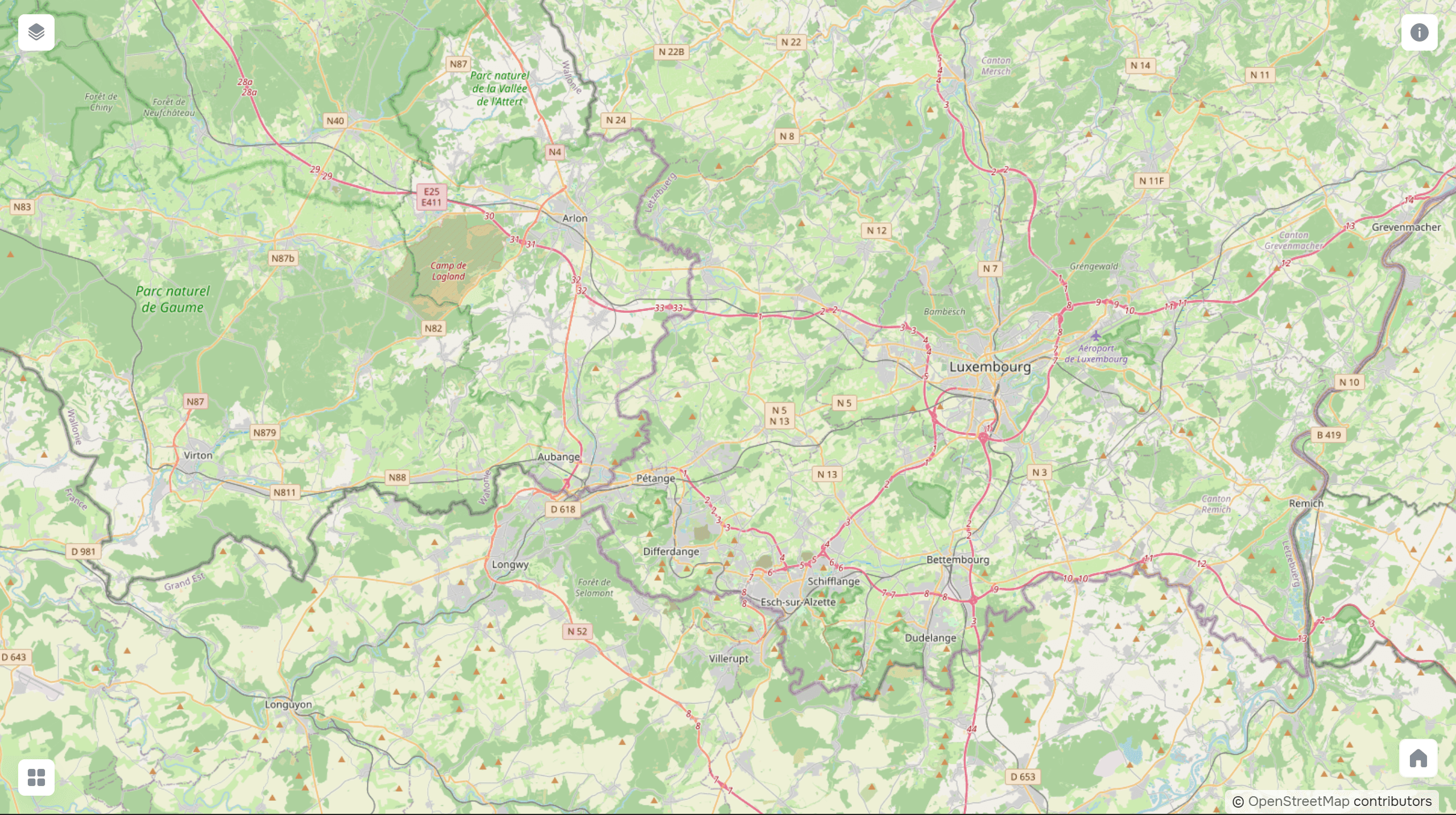
Standard. Classic maps with roads and labels. This is a universal option suitable for most tasks, especially when infrastructure is important.
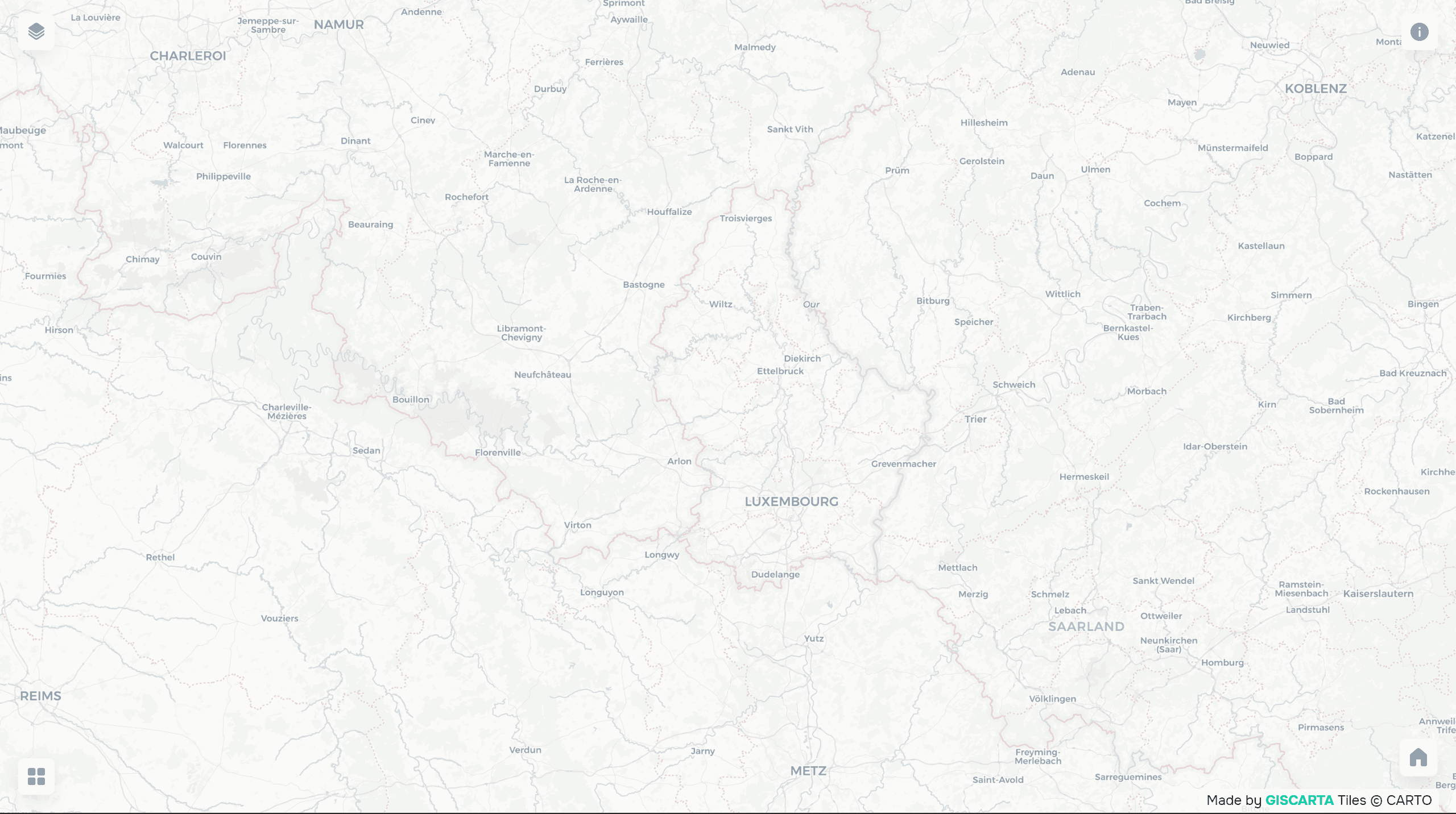
Light. Minimalistic maps with muted colors. They are used when the main focus should be on the data, not the background.
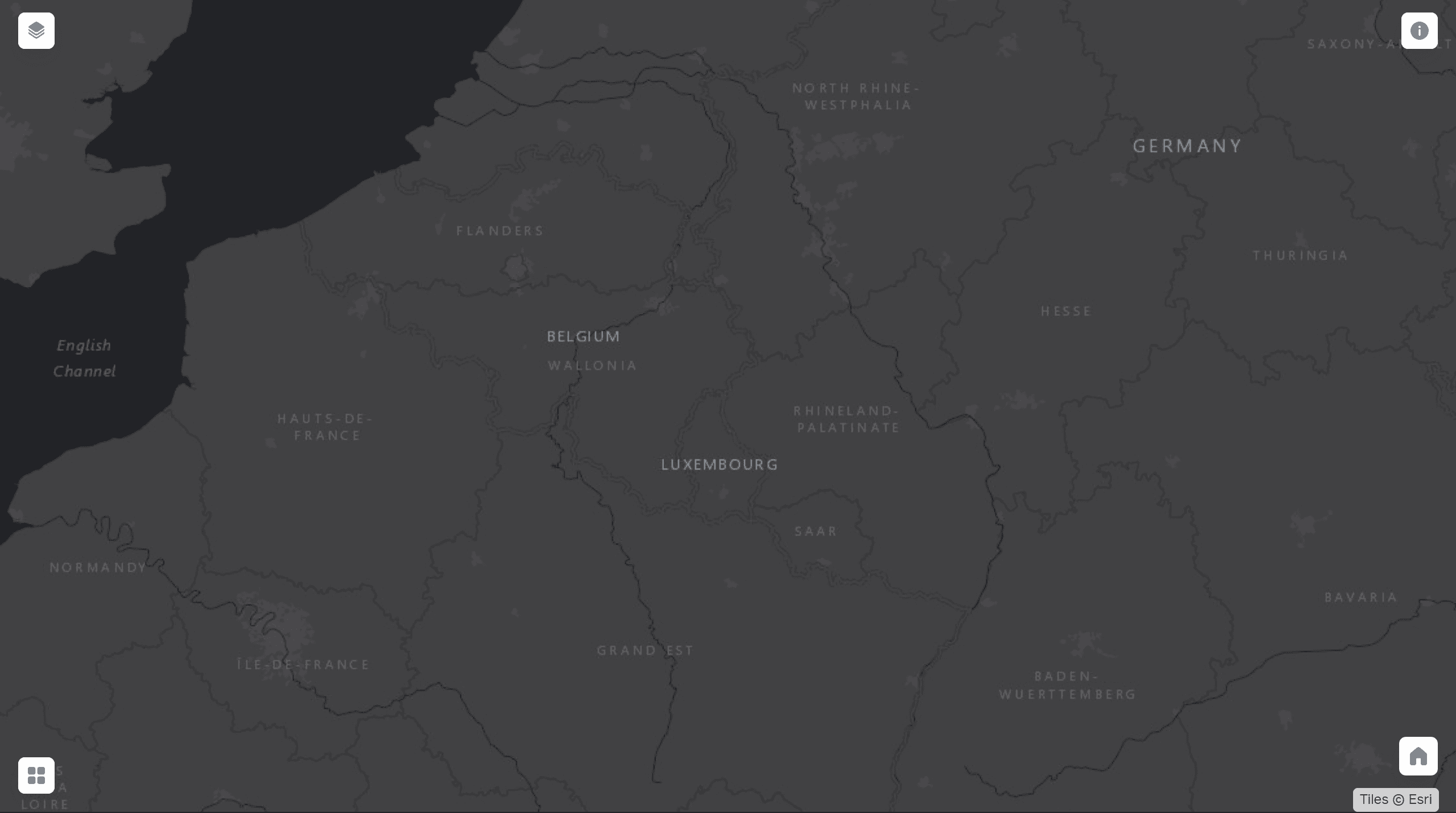
Dark. Suitable for presentations and dashboards, especially in interfaces with a dark theme. They highlight bright data well.
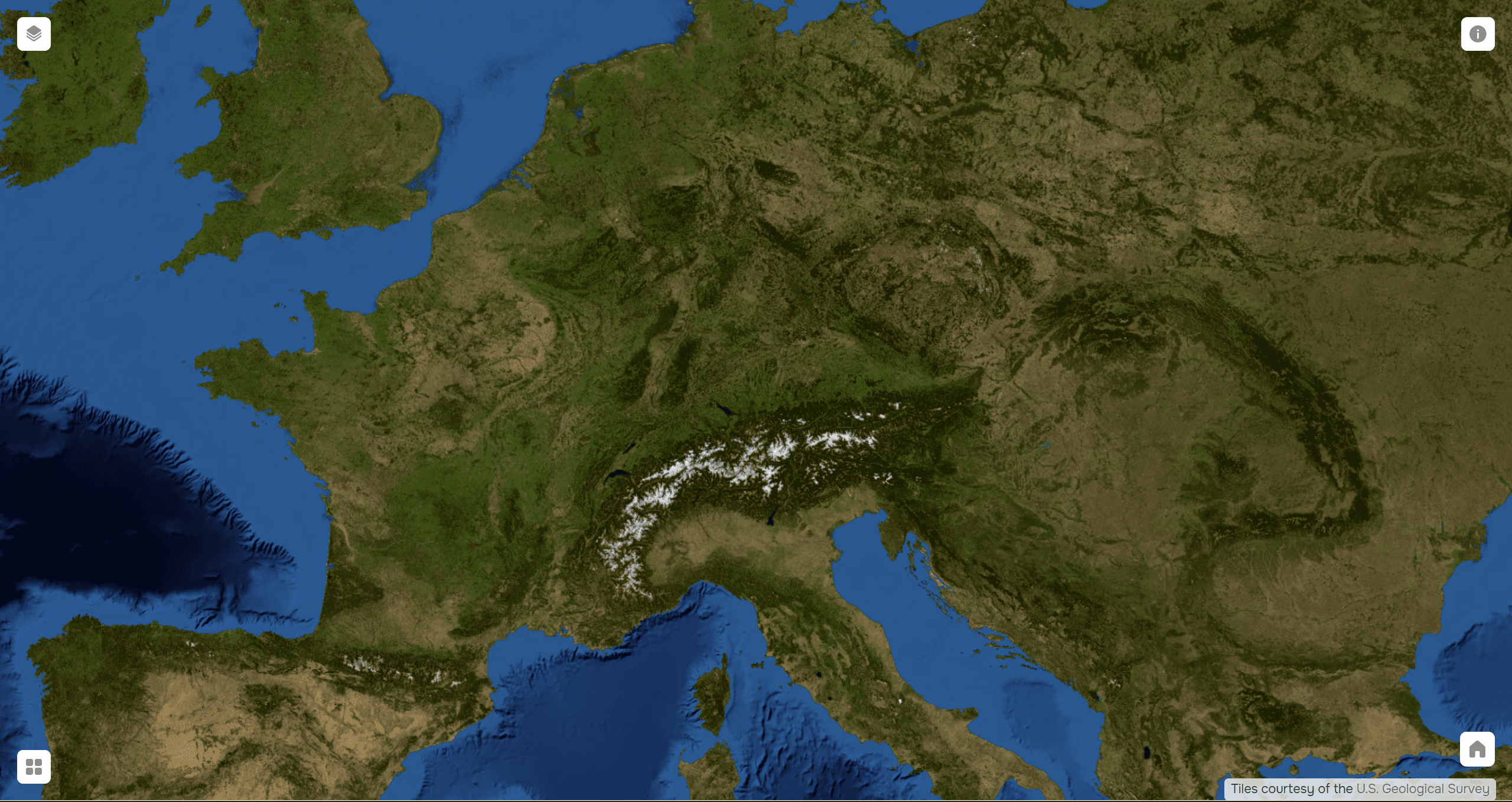
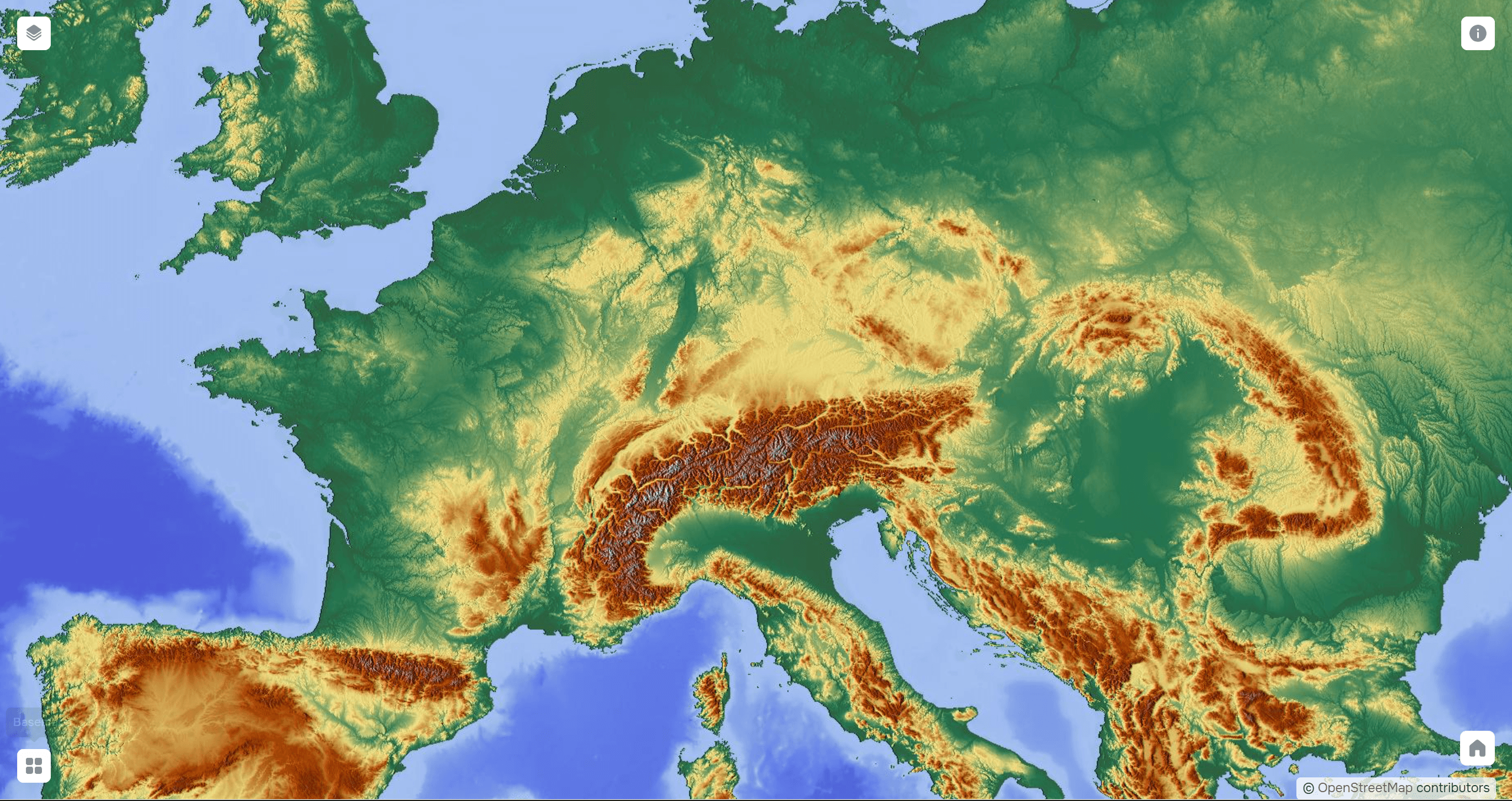
Satellite. Show the actual surface image. They are used when the context of the terrain is important: vegetation, buildings, landscape.
Terrain. Shows elevation and relief features. They are useful for analyzing natural processes and visualizing terrain.
How to Choose a Basemap
The choice of basemap depends on the task. If you need to show infrastructure, a standard map with roads is best. If the task is to visualize analytical data, light basemaps are preferable, as they do not distract.
Dark maps are often chosen for presentations and dashboards, as they add more contrast to the data. Satellite and relief maps are used when the physical context of an area is important.
Important: a basemap should not compete with the underlying data. Its purpose is to support, not distract.
Basemaps in GISCARTA
The user can quickly switch between different styles, selecting the optimal option for the task. This is convenient when working with dashboards and analytical maps, where it is important to quickly test how the data is perceived.
Basemaps in GISCARTA are integrated into the platform interface, so they require no additional configuration. This allows you to focus on analysis, not technical details. All the basemaps on GISCARTA can be viewed here.
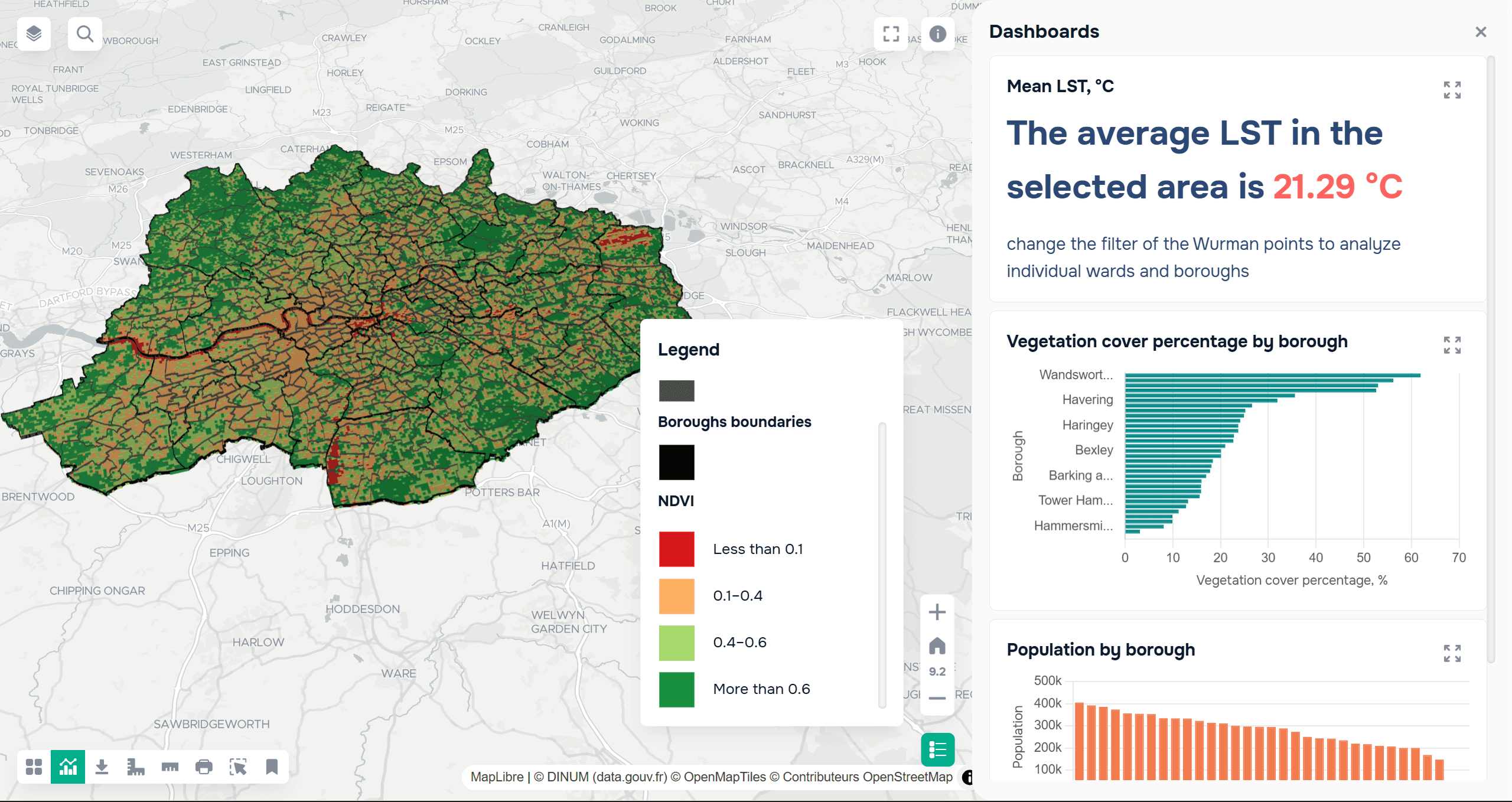
An example of a cartographic project on GISCARTA on a light background.
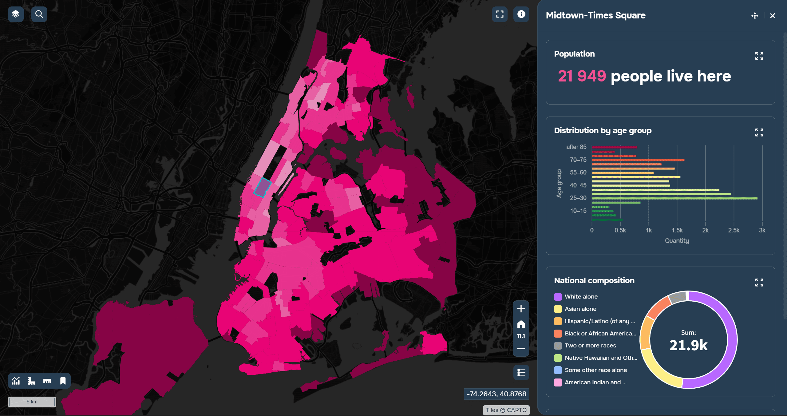
An example of a cartographic project on GISCARTA on a dark background.
The Role of a Basemap in Analytics
Although a basemap does not contain analytical data, it directly impacts the perception of the results.
For example, population density may be difficult to read on a brightly colored map, whereas it becomes clear on a light background. Similarly, transportation data is more easily understood on a map with roads than on a minimalist one.
Thus, a basemap is part of the visual logic that helps the user interpret the data more quickly.
Common Mistakes
One of the most common mistakes is choosing an overly detailed basemap. Too many elements distract and complicate comprehension.
Another common problem is color, where the basemap clashes with the data. For example, a bright background can overpower thematic layers.
Another mistake is using a single basemap for all tasks without considering the context.
FAQ
Can a single basemap be used for all projects?
Technically, yes, but in practice, it's better to tailor it to the specific task.
What's more important: the basemap or the data?
Data, but without the right basemap, it's harder to understand.
When to use a satellite map?
When real-world context is important.
Key Takeaways
The basemap sets the context and influences how the data is perceived.
The choice of basemap should be driven by the task, not by habit.
Minimalistic basemaps are often better suited for analytics.


