
When working with spatial data, it's important not only to display features on a map but also to manage their attribute information. For this purpose, most GIS systems offer a "Field Calculator" tool, which allows you to automatically populate, modify, and calculate attribute values without having to manually edit each record.
The Field Calculator is a bulk data editing tool. The user defines an expression or calculation rule, which is then applied to all selected features in the layer. This significantly speeds up data processing and reduces the likelihood of errors during manual entry.
This tool is used in virtually all modern GIS platforms and is one of the essential tools for preparing data before analyzing, visualizing, or publishing maps.
Why use the Field Calculator
In real-world projects, attribute tables can contain thousands or even millions of objects. Manually changing each value is time-consuming and increases the risk of errors. The Field Calculator automates tasks such as:
bulk updating attribute values;
calculating new metrics based on existing fields;
copying information between columns;
converting text and numeric data;
filling empty values;
creating new attributes for subsequent analysis.
Using the calculator is especially useful when preparing data for spatial analysis, building thematic maps, creating reports, and working with large datasets.
Main Functions of the Field Calculator
Depending on the capabilities of the GIS platform, the field calculator supports various types of calculations.
Mathematical Operations
Perform arithmetic calculations between fields or with constant values. For example:
Calculating population density;
Calculating object costs;
Converting units of measurement;
Calculating percentages.
Working with Text
The calculator allows you to concatenate strings, change the case of characters, replace text, or extract individual parts of a string. For example:
Concatenate the name of a city and region;
Create a full address;
Convert text to upper or lower case.
Conditional Expressions
Using logical conditions, you can automatically assign different categories to objects. For example:
If the population exceeds a specified value, assign the category "Large City";
If the area is less than a certain threshold, mark the object as "Small Area."
This allows you to quickly classify large volumes of data.
Working with Geometry
In many GIS systems, the calculator can retrieve the geometry characteristics of objects. For example:
area of polygons;
length of lines;
point coordinates;
perimeter of objects.
Such calculations are especially in demand when working with cadastral data, utility networks, and natural features.
How does the field calculator work in GISCARTA?
To use the field calculator on the platform, go to the layer's Properties.
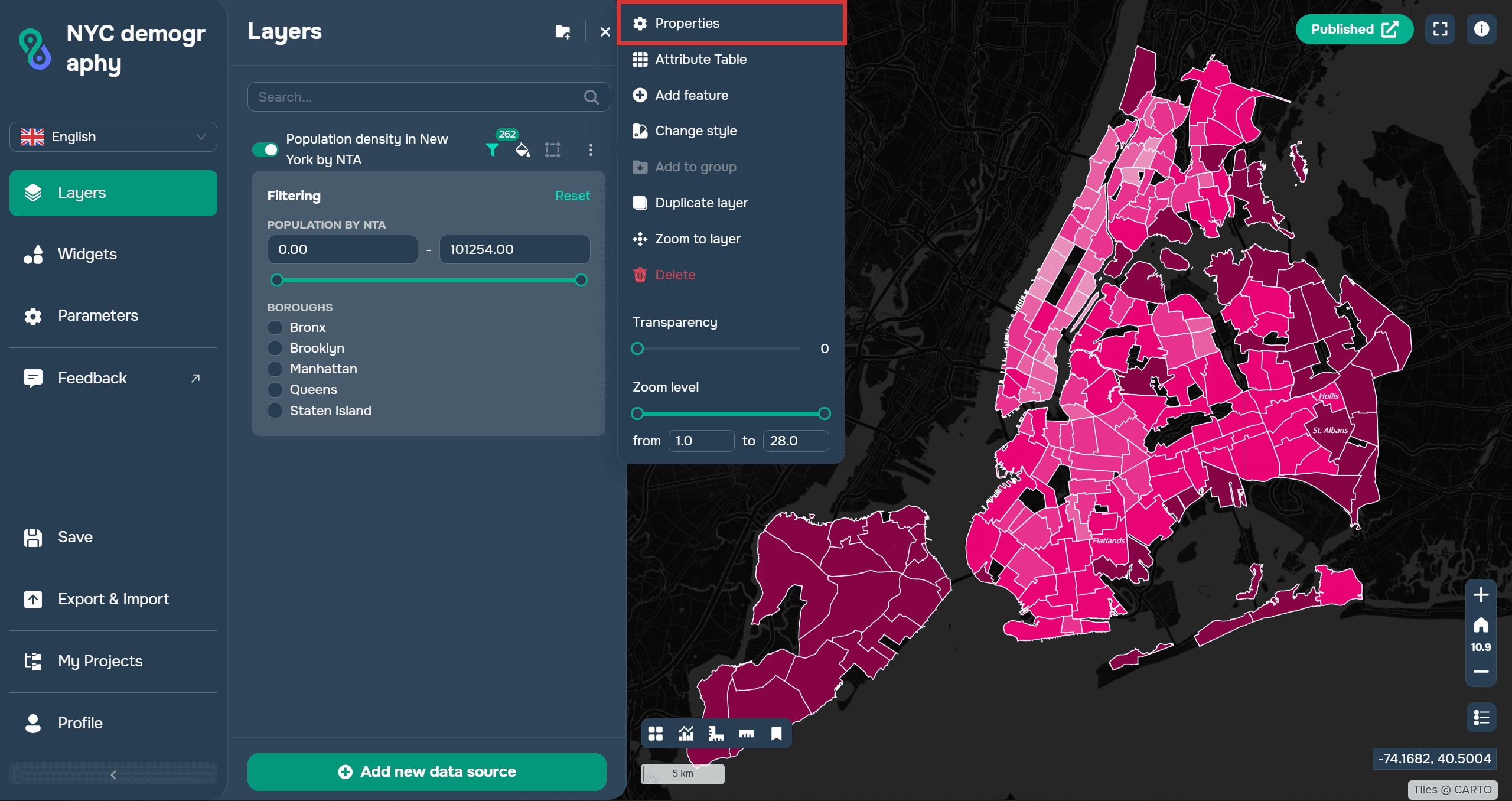
Next, select the Fields section on the top menu bar.

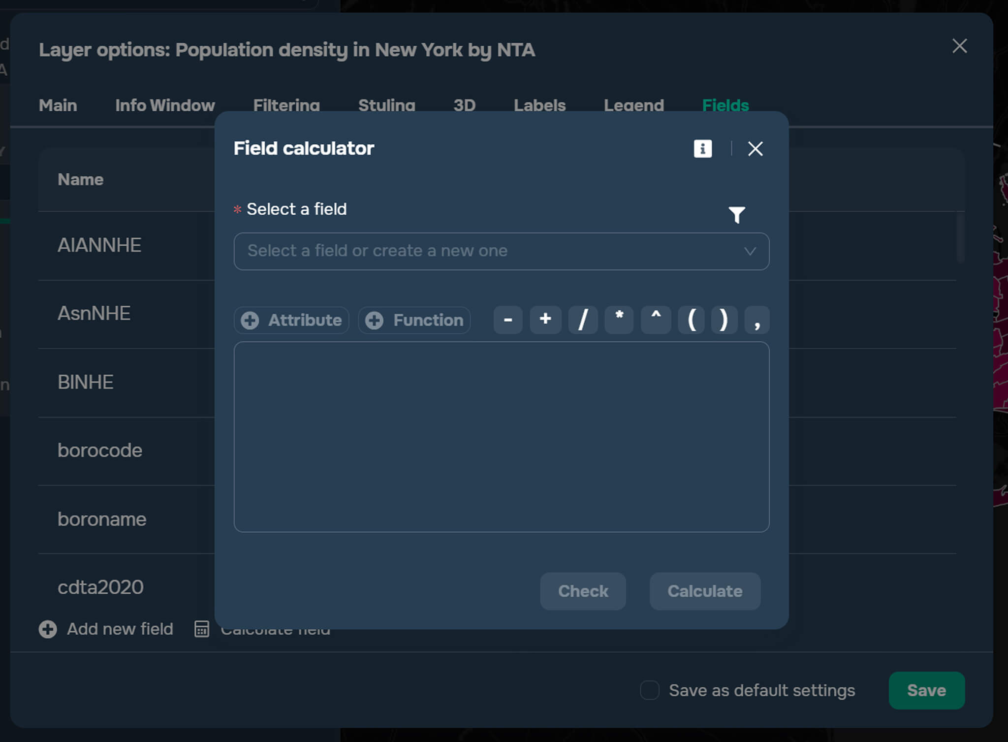
To enter the Calculate field, you need to select the button at the bottom of the working window next to Add new field.

The Field Calculator allows users to calculate existing fields or create new ones. Some standard functions for working with text and numeric data are available to the user.
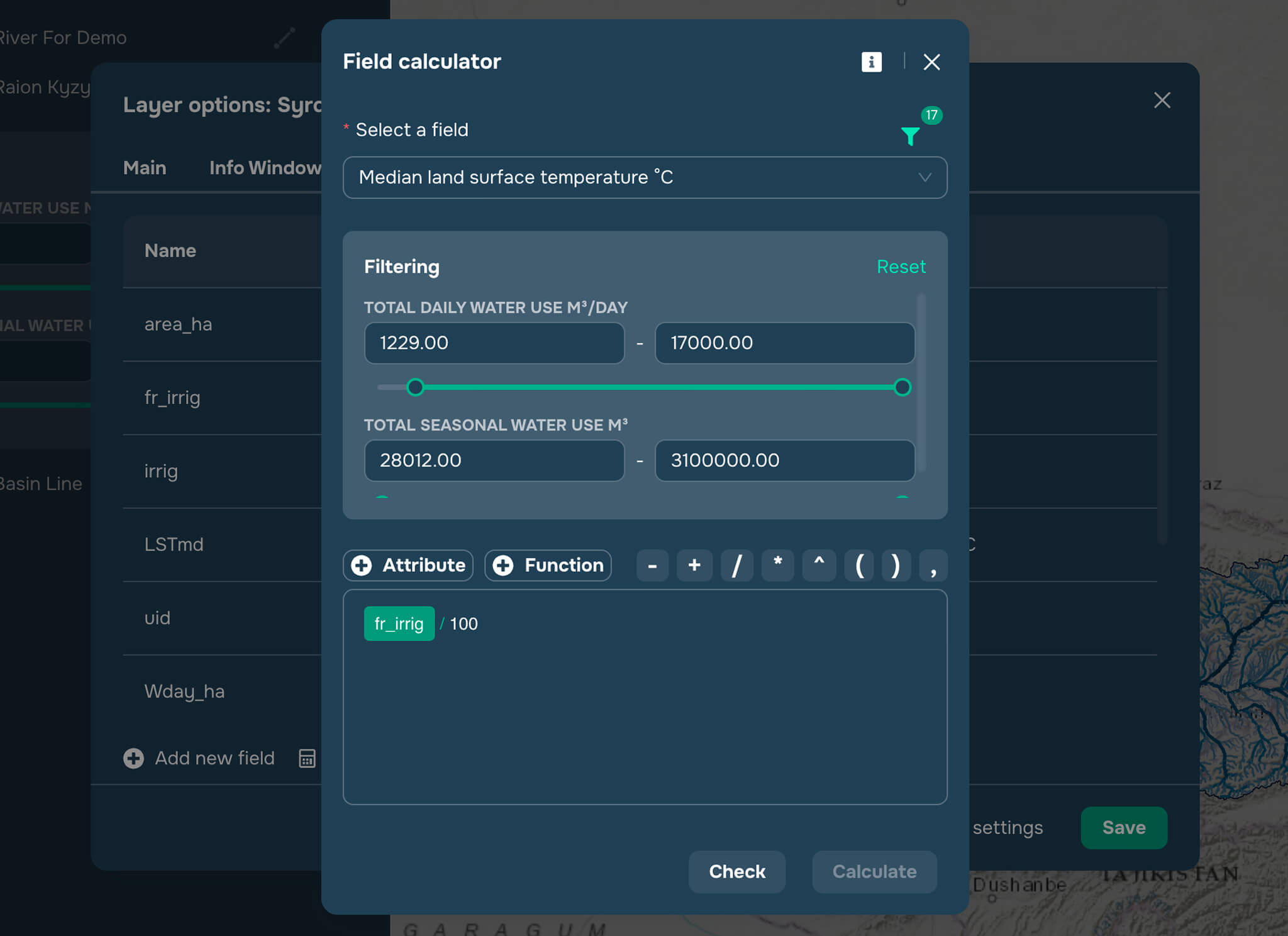
When calculating a field, the user can also apply the configured layer filter.
FAQ
What is a field calculator?
The field calculator is a tool for automatically calculating and bulk updating feature attribute values in a GIS.
Can I create new fields using the calculator?
Yes. Most GIS systems, including GISCARTA, allow you to create new attribute fields and immediately populate them with calculated values.
What are the most common tasks for using the field calculator?
It is used to calculate areas and lengths, update attributes, classify features, create new indicators, and prepare data for analysis and visualization.
Key Takeaways
The field calculator allows you to automatically modify and calculate attribute data for a large number of features at once.
Automated calculations reduce data processing time, reduce errors, and make working with a GIS more efficient.
In GISCARTA, the field calculator helps you quickly update data and prepare layers for analysis, visualization, and collaboration.



