
Geographic information systems (GIS) have become an integral part of the modern oil and gas industry. They are used at all stages of the field life cycle: from prospecting and drilling planning to pipeline operation and environmental monitoring. By integrating maps, satellite images, geological survey results, and sensor data into a single system, GIS helps make more informed decisions, reduce costs, and improve facility safety.
What spatial data is used in the oil and gas industry?
Oil and gas companies rely on analyzing large amounts of spatial information. Depending on the task, specialists use various types of data:
geological and tectonic maps;
seismic survey results;
digital elevation models;
satellite imagery;
aerial photography and drone data;
well and well pad locations;
pipelines and infrastructure;
utilities;
hydrographic features;
climatic and environmental data;
field survey results.
All of this data is coordinate-referenced and can be analyzed together. This approach allows for a more complete picture of the territory and the identification of patterns that are difficult to detect using individual sources of information.
Field Search and Exploration
One of the first tasks where GIS is applied is identifying promising areas for oil and gas exploration.
At this stage, specialists combine geological maps, seismic survey results, satellite images, and data from previously drilled wells. This combined analysis helps identify areas with the highest probability of hydrocarbon deposits.
For example, a geologist can overlay a tectonic fault map with seismic survey results and a digital elevation model to identify structures promising for drilling. This approach reduces the amount of costly fieldwork and increases the efficiency of geological exploration.
Drilling and Construction Planning
Once a promising site has been selected, the design phase begins.
Using GIS, specialists analyze:
terrain;
transport accessibility;
distance to existing infrastructure;
wetlands;
rivers and water bodies;
protected natural areas;
natural hazard zones.
Based on this data, the optimal location for the drilling rig, access roads, and supporting infrastructure is selected. Spatial analysis helps reduce construction costs and minimize environmental impact.
Pipeline Management
One of the most important areas of GIS application is the operation of pipeline systems. A geographic information database can store information on:
pipeline routes;
pipe diameters and materials;
service life;
valve configurations;
pumping and compressor stations;
repair and inspection histories.
Using a GIS, an engineer can quickly identify areas requiring repair, assess the potential consequences of an accident, and plan the work. Many companies use mobile GIS applications, which allow field crews to obtain up-to-date maps, record inspection results, and transmit data to the corporate system in real time.
Environmental Monitoring
Oil and gas projects require continuous environmental monitoring. GIS helps track:
land cover changes;
soil pollution;
potential oil spills;
river and lake conditions;
compliance with sanitary protection zone boundaries;
the impact of construction on natural areas.
Satellite imagery and drone data are widely used for monitoring. Comparing images obtained over different time periods allows for the timely detection of landscape changes, soil subsidence, and signs of pollution.
Modern Technologies
The development of digital technologies has significantly expanded the application of GIS in the oil and gas industry.
Satellite monitoring is used to monitor pipeline conditions, detect changes in the earth's surface, and monitor construction.
Unmanned aerial vehicles (UAVs) enable inspection of pipelines, tanks, and drilling sites, as well as the creation of highly accurate orthophotomaps and 3D terrain models.
The Internet of Things (IoT) enables continuous data collection from pressure, temperature, and flow sensors. This information is automatically fed into a GIS and displayed on a map in near real time.
Artificial intelligence helps analyze large volumes of spatial data, identify anomalies, predict the likelihood of accidents, and automatically detect signs of leaks using satellite imagery.
Benefits of Using GIS
Using geographic information systems allows oil and gas companies to:
reduce exploration and construction costs;
accelerate spatial data analysis;
improve operational safety;
respond promptly to emergencies;
reduce environmental risks;
centralize data storage and updating;
improve collaboration between departments.
Instead of multiple individual maps and tables, specialists receive a single digital model of the territory that is constantly updated and accessible to various company departments.
Examples of GIS Use in Oil and Gas Companies
Shell has been using ArcGIS technologies for over 20 years. GIS is used in exploration, field development, production, infrastructure planning, and spatial data management. To improve accessibility of geodata, the company developed the OneGulf Atlas enterprise application, which integrates mapping services and allows employees to work with up-to-date spatial information in a single environment.
BP uses GIS for spatial analysis in hydrocarbon exploration and production, as well as to support production processes and engineering decision-making. For its large-scale implementation of geoinformation technologies, BP received a Special Achievement in GIS award from Esri.
At ExxonMobil, the ArcGIS Enterprise corporate platform is used by thousands of employees worldwide. This geographic information system helps manage production infrastructure, monitor service status, provide access to spatial data, and support the global GIS platform. The company also uses GIS to analyze production facilities and optimize real estate and infrastructure management.
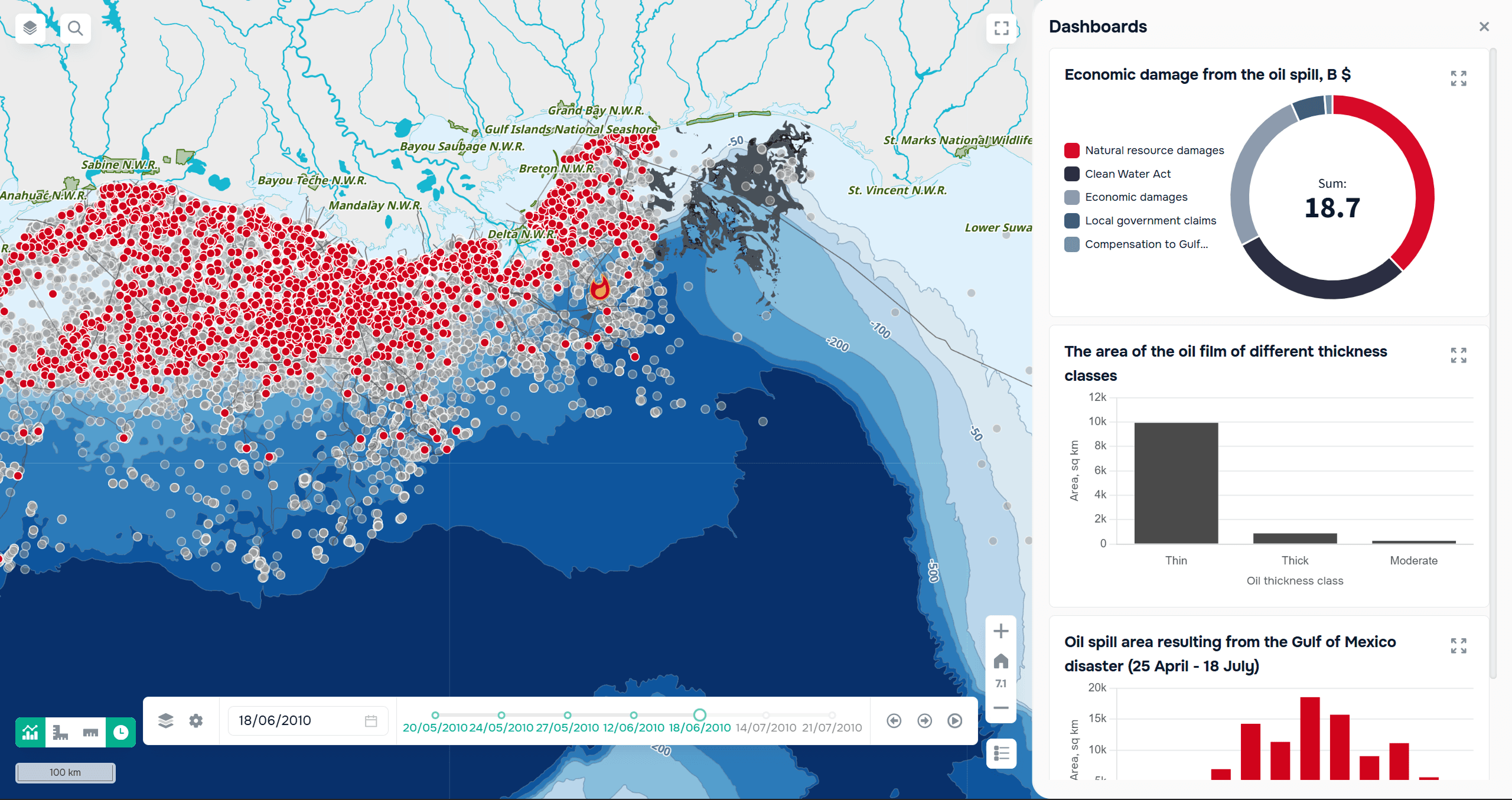
An example of the Gulf of Mexico oil spill data display on the GISCARTA platform
FAQ
How is GIS used in the oil and gas industry?
GIS supports exploration, drilling planning, pipeline management, environmental monitoring, and infrastructure management.
Why is GIS important for oil and gas companies?
It improves decision-making, reduces costs, enhances safety, and helps manage large volumes of spatial data.
Key Takeaways
GIS is used throughout the entire oil and gas project lifecycle.
Spatial analysis improves operational efficiency and safety.
Modern GIS integrates satellite imagery, drones, IoT, and AI for smarter asset management.



