
Geographic information systems have long ceased to be a tool exclusively for cartographers and geographers. Today, GIS is used in a wide range of fields: from urban management and transportation to agriculture, ecology, and business. Maps are gradually becoming interfaces for spatial data analysis, and GIS itself is becoming a platform that integrates information from multiple sources.
In recent years, the volume of geodata has grown significantly. Satellite observation systems, sensors, mobile devices, and internet services are constantly generating new spatial data. All this is shaping new technological trends and changing the approach to using geographic information systems.
Let's look at the key trends shaping GIS development in 2026.
Artificial Intelligence (AI)
One of the most noticeable trends has been the active use of artificial intelligence in geographic information systems. Machine learning technologies enable the automatic analysis of satellite imagery and other spatial data.
For example, computer vision algorithms can recognize buildings, roads, agricultural fields, and bodies of water in images. This significantly accelerates the processing of Earth observation data. Previously, such analysis required manual processing and was time-consuming, but now many processes can be performed automatically.
In line with this trend, GISCARTA has released the Geodata AI widget, which helps download open data. This widget allows you to download data from OSM, Overture Maps, and Kontur population data using various queries.
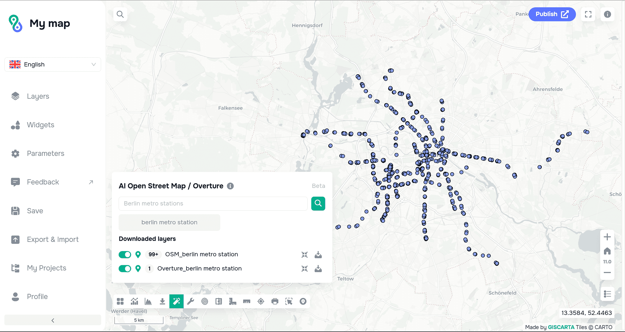
Example of Geodata AI widget usage.
More details about the widget can be found here.
3D and Digital Twins
Another important trend is the transition from two-dimensional maps to three-dimensional models of cities and territories. In recent years, 3D GIS, which allows for spatial analysis not only on a flat surface but also in volume, has been rapidly developing.
Particular attention is being paid to the creation of digital twins of cities. These are virtual models of real territories that include buildings, roads, utility infrastructure, and other elements of the urban environment.
Such models are used for various purposes: traffic flow analysis, urban development planning, impact assessment of new construction projects, and infrastructure management.
You can add layers with the Height attribute to the GISCARTA platform, as well as add 3D models of point objects.
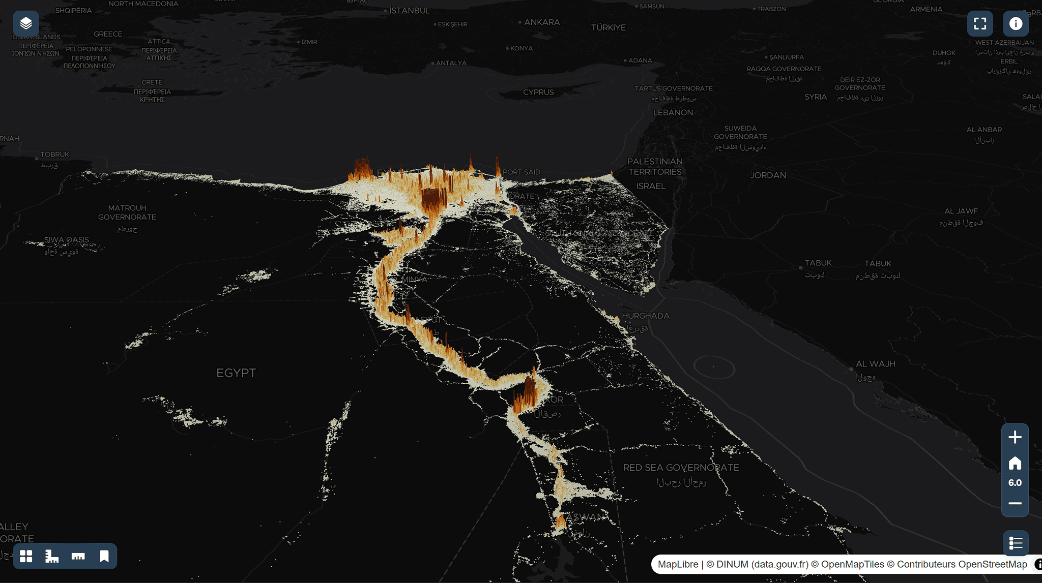
An example of using population data in Kontur in 3D.
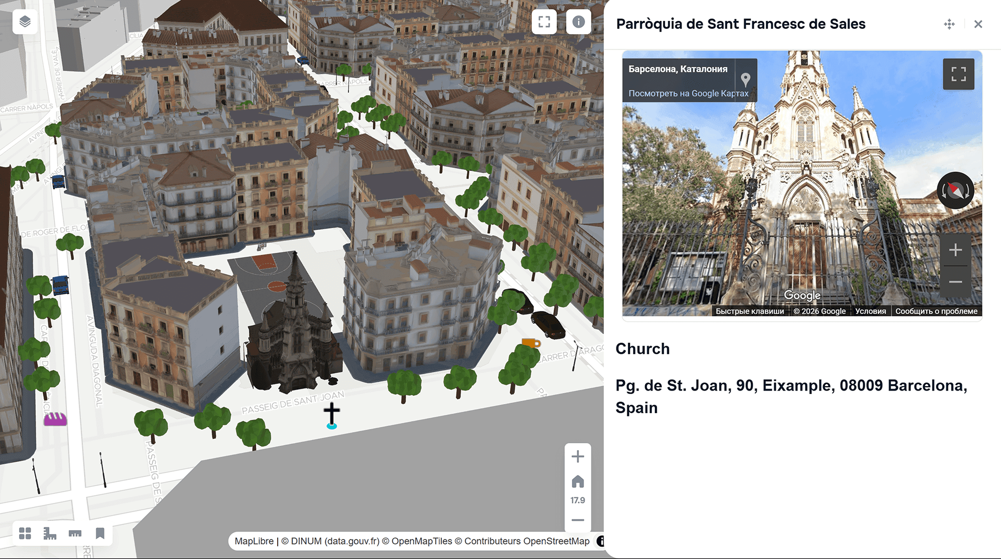
An example of adding 3D models of Barcelona buildings to the GISCARTA platform
More details about the widget can be found here. Read more about digital twins on our blog.
Cloud GIS Platforms
Just a few years ago, most GIS solutions were installed on local computers and used by a limited number of specialists. Today, cloud GIS platforms are increasingly used, allowing users to work with spatial data over the internet.
This makes geoinformation technologies more accessible. Geodata is now actively used not only by GIS specialists but also by developers, data analysts, researchers, and city services.
GISCARTA allows you to store, process, and visualize big data directly in the web version. This solves the problem of low computer memory and weak hardware.
The platform also allows you to upload data not only from your computer but also from external sources, such as Open Geospatial Consortium (OGS) standards such as WMS, WFS, or WMTS.
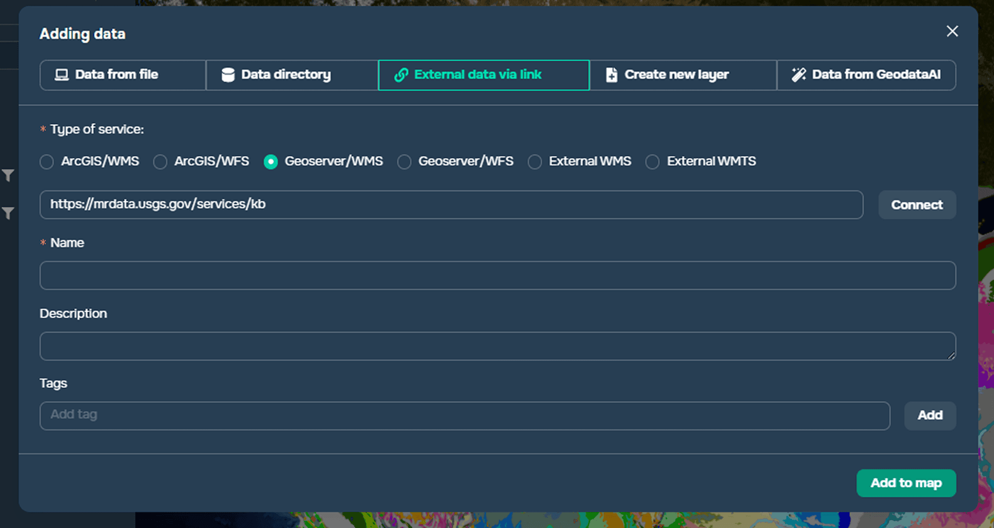
Example of adding open WMS/WFS data.
Real-Time Data
With the development of the Internet of Things and sensor technologies, more and more data is being received in real time. This could include traffic data, environmental sensor readings, weather information, or mobile device data.
One of the advantages of web GIS is its ability to retrieve information from the internet in real time. This allows for monitoring various parameters, such as flows, forest fire boundaries, and road traffic.
The GISCARTA platform does not yet support real-time data processing, but there are tools that can display these changes in animation.
Using the Timeslider widget, you can display changes over time on a map. A timeline is built using a date attribute, which is then used to create an animation to visualize these changes.
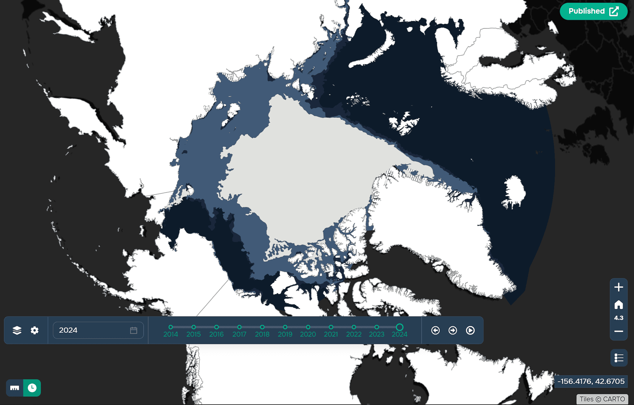
An example of using a Timeslider widget on the GISCARTA platform.
Growing Volumes of Open Data
One of the notable trends of recent years has been the rapid growth of open geospatial data. More and more government organizations are publishing geodata as part of open data initiatives. For example, national geoportals in many countries provide open data on territorial boundaries, transportation infrastructure, cadastral objects, and population statistics.
Another important source of open geodata is the OpenStreetMap project, which is being developed by a community of users worldwide.
Furthermore, a significant portion of satellite data is now available free of charge. For example, the Copernicus Sentinel and Landsat programs provide open satellite images of the Earth, which are widely used for agricultural monitoring, land-use change analysis, and environmental research.
The GISCARTA platform openly provides datasets such as: airports worldwide, countries worldwide, metro systems of cities with a population of over a million, etc.
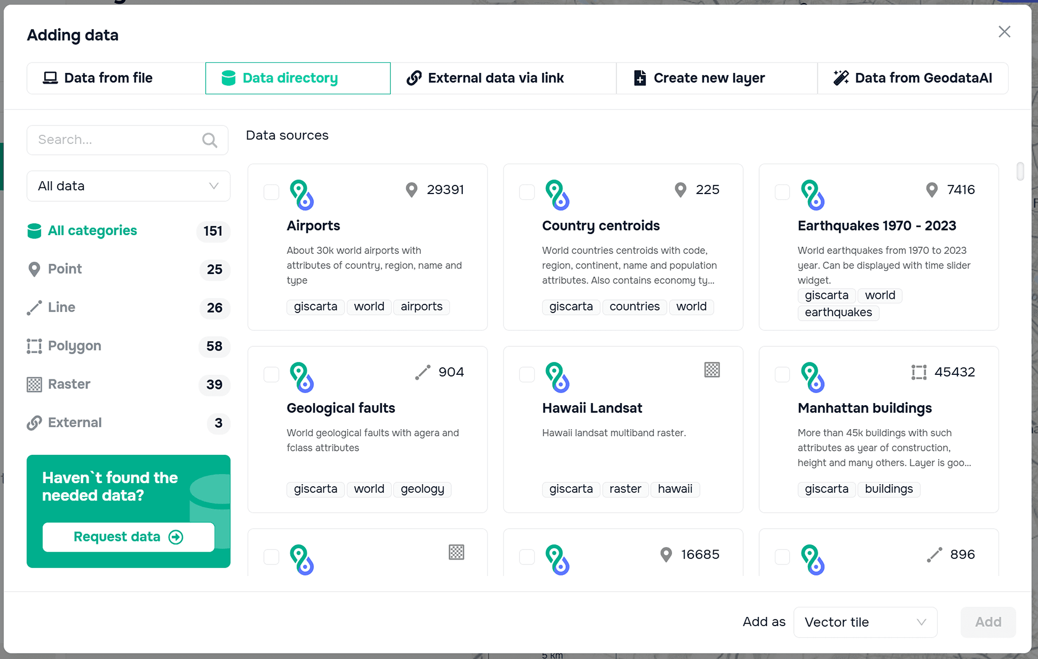
An example of open data on the GISCARTA platform.
You can read more about open data sources in our blog.
FAQ
Why is artificial intelligence becoming important in GIS?
AI helps automate the analysis of large geospatial datasets, such as satellite imagery, allowing faster detection of objects, land-use changes, and environmental patterns.
What are digital twins in GIS?
Digital twins are virtual 3D models of real-world environments, such as cities or infrastructure systems, used for simulation, planning, and monitoring.
Why are cloud GIS platforms becoming more popular?
Cloud GIS allows users to store, process, and visualize geospatial data online, making GIS tools accessible without powerful local hardware.
Key Takeaways
Artificial intelligence and automation are transforming how spatial data is processed and analyzed in GIS systems.
3D models and digital twins enable more advanced analysis of cities and infrastructure.The growth of open geodata and cloud platforms is making GIS technologies more accessible to a wider range of users.


