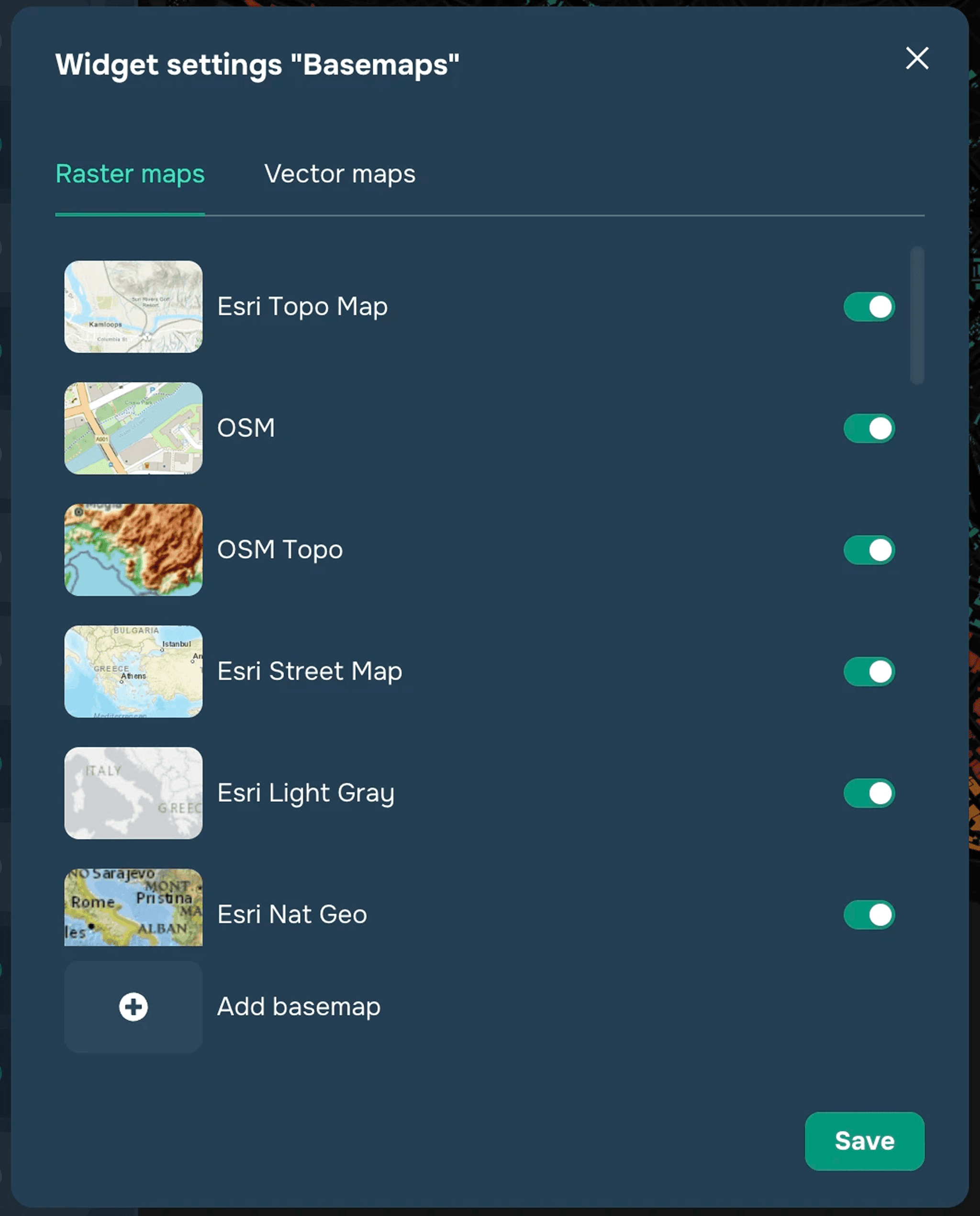
Widget settings
To set up the widget, click on the three dots next to the name of the widget and select "Configure."

In the drop-down dialog box you will see raster and vector basemaps (substrates) available for selection, for example: OSM (Open Street Map), Open Topo map, Topo, Google, ESRI World Street Map, etc.
You can select any substrate from the list and add it by clicking on the switch next to the base map, after which it will be available for selection when using the widget.
To upload a basemap, click "Add Basemap". Here you can add both a raster and vector tile basemaps. To add a basemap, you will need to create a name for it in the window that appears and paste the map link and the preview link.
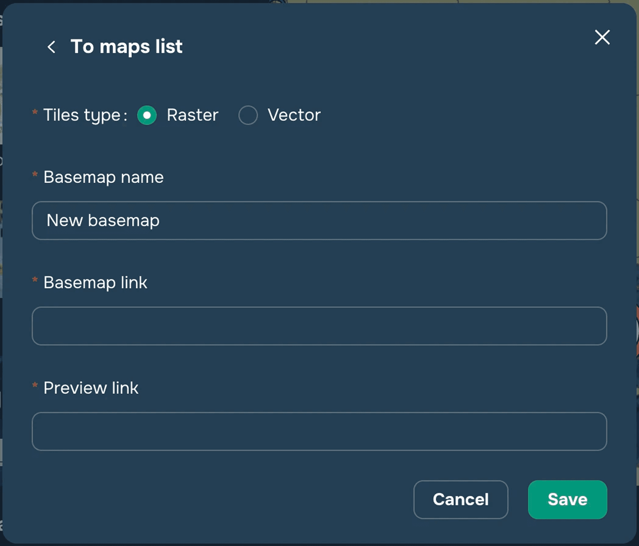
For example
For raster:
Title — "Dark theme"
Map link — https://c.basemaps.cartocdn.com/rastertiles/dark_nolabels/{z}/{x}/{y}.png
Preview link — https://c.basemaps.cartocdn.com/rastertiles/dark_nolabels/2/1/1.png
For vector:
Title — Toner VT
Map link — https://openmaptiles.geo.data.gouv.fr/styles/maptiler-toner/style.json
Widget description
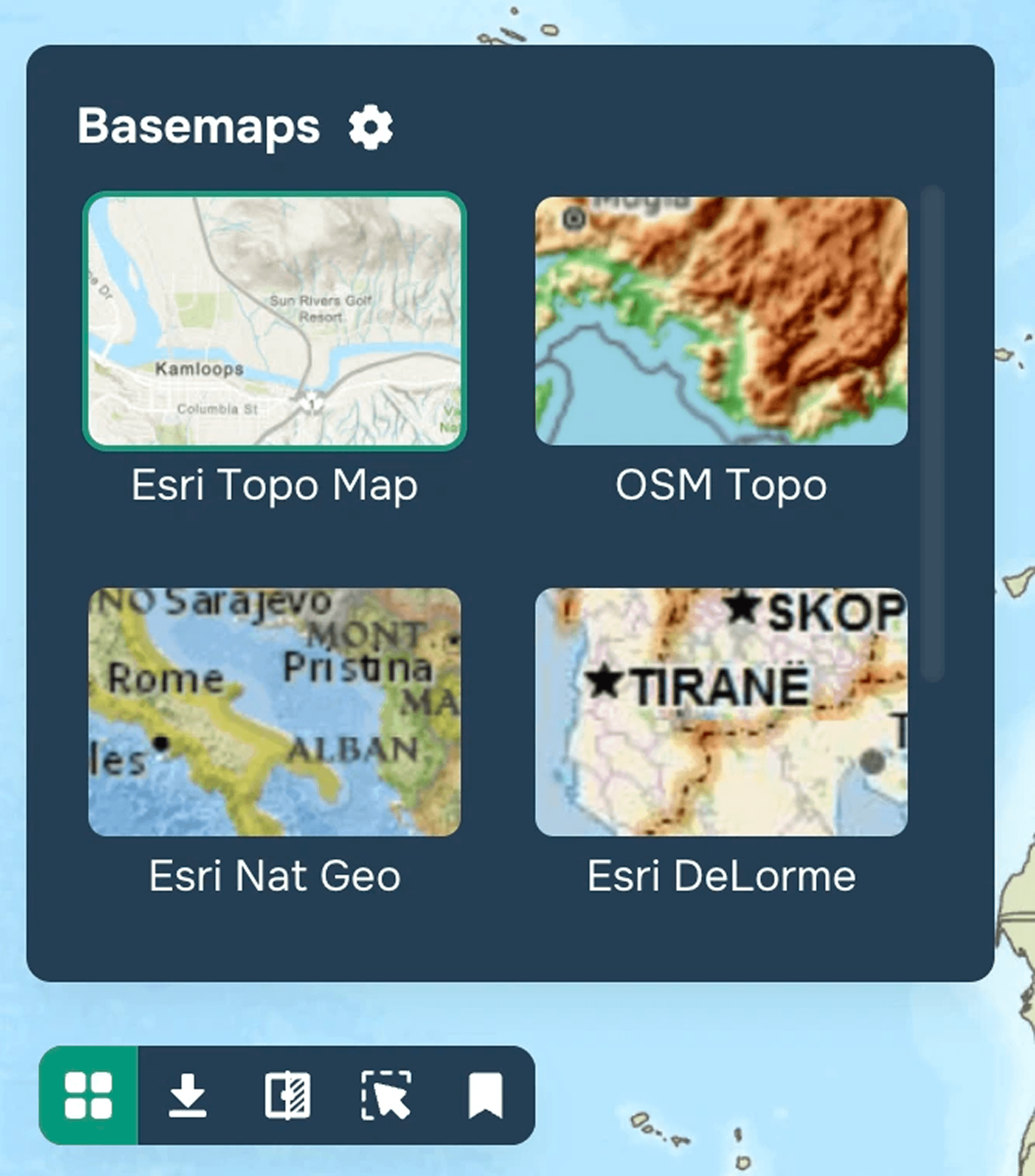
Click the "Gallery" icon in the lower left corner of the map window and select the current base substrate (map) for your project. To close the window, click the "Gallery" icon again (see Figure 3).